
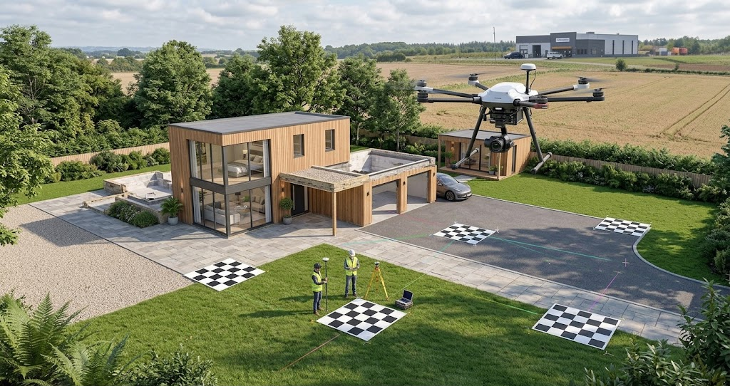
Drone mapping provides detailed aerial data for surveying, construction, agriculture, and land management. However, the quality of the resulting maps depends on how accurately aerial images are positioned in real-world coordinates. Ground control points (GCPs) help improve this accuracy by connecting drone imagery to precisely measured locations on the ground.
Understanding Ground Control Points in Drone Mapping
Ground control points are identifiable markers placed at known locations across a survey area. Their coordinates are measured using surveying equipment, often with high-precision GNSS receivers. During photogrammetry processing, these coordinates help align aerial images with their actual geographic positions.
Without sufficient ground control, a drone mapping project may produce a visually consistent model that still contains positional errors. GCPs provide reliable reference locations that help reduce these discrepancies.
Identifying Suitable Ground Control Points
Effective ground control points must be easy to recognise in aerial photographs and accurately measured on the ground. Their suitability depends on visibility, surface conditions, and the precision required for the project.
Useful characteristics include:
-
High visibility: Markers should contrast with the surrounding surface and remain clearly identifiable in multiple images.
-
Stable placement: Points should not move between ground measurement and drone data collection.
-
Precise coordinates: Survey measurements should meet the accuracy requirements of the mapping project.
-
Clear identification: Each marker should have a recorded position and a corresponding identifier in the survey data.
Selecting appropriate markers reduces ambiguity during image processing and helps produce more dependable mapping results.
Improving Positional Accuracy and Georeferencing
One of the main benefits of GCPs is their ability to improve georeferencing accuracy. Georeferencing establishes the relationship between a digital map or model and real-world coordinates. This allows mapped features to be compared with property boundaries, engineering plans, existing geographic information systems, and other spatial datasets.
Drone cameras capture overlapping images from different positions. Photogrammetry software identifies common features across these images and uses them to reconstruct the surveyed environment. Ground control points provide additional coordinate references that constrain this reconstruction.
Reducing Horizontal and Vertical Errors
Positional errors can affect both the horizontal location and elevation of mapped features. Ground control points help constrain these errors by providing known reference positions throughout the survey area.
Their contribution can be especially important when mapping terrain, road corridors, construction sites, or other locations where small discrepancies may affect measurements.
GCPs can help improve:
-
Horizontal accuracy: The mapped position of roads, structures, boundaries, and other ground features.
-
Vertical accuracy: Elevation estimates used in terrain models and surface analysis.
-
Model consistency: The alignment of aerial imagery and reconstructed three-dimensional features.
-
Measurement reliability: The usefulness of mapped distances, areas, and elevations for subsequent analysis.
Actual accuracy depends on the quality of the ground measurements, image resolution, flight conditions, camera calibration, and processing methods.
Optimising Ground Control Point Distribution
The number of ground control points is important, but their distribution across the survey area is equally significant. Concentrating all markers in one location can leave other sections poorly constrained, particularly across large or irregular sites.
A well-planned arrangement should represent the full extent of the area being mapped. Points are commonly distributed around the perimeter and throughout the interior, with additional consideration given to changes in terrain and elevation.
Avoiding Poor Placement
Ground control points should be positioned where they are visible in several overlapping images and can be measured reliably. Certain placement problems can reduce their effectiveness:
-
Clustering markers: Too many points in one small area may leave distant sections insufficiently controlled.
-
Ignoring elevation changes: Uneven terrain may require a distribution that captures variations in height.
-
Choosing obstructed locations: Vegetation, shadows, buildings, or equipment can make markers difficult to identify.
-
Using unstable surfaces: Loose soil or frequently disturbed areas can compromise coordinate reliability.
The ideal number and arrangement of points depend on the survey’s size, terrain, required accuracy, and processing workflow. Larger or more complex projects may require additional control.
Verifying Accuracy With Independent Checkpoints
Ground control points help guide photogrammetry processing, but they should not be the only means of evaluating the final results. Independent checkpoints provide a separate way to assess positional accuracy.
Unlike GCPs used to constrain the model, checkpoints are measured at known locations but excluded from the adjustment process. Comparing their surveyed coordinates with their mapped positions reveals how closely the final outputs match independent reference measurements.
Evaluating Mapping Results
Accuracy assessments should consider the project’s intended use and applicable standards. Important steps include:
-
Comparing mapped checkpoint coordinates with independently surveyed positions.
-
Calculating horizontal and vertical discrepancies.
-
Reviewing residual errors to identify potential processing or measurement problems.
-
Confirming that results satisfy the project’s specified accuracy requirements.
This distinction matters because a model can fit its control points closely without achieving the same accuracy across the entire survey area.
Combining well-positioned GCPs with independent checkpoints provides a stronger basis for evaluating mapping accuracy. For projects requiring dependable spatial information, careful ground control planning by experts in the field helps produce more consistent and useful mapping outputs.